.png)
.png)
.png)
.png)
.png)

.png)

Challenges for Drone Operators
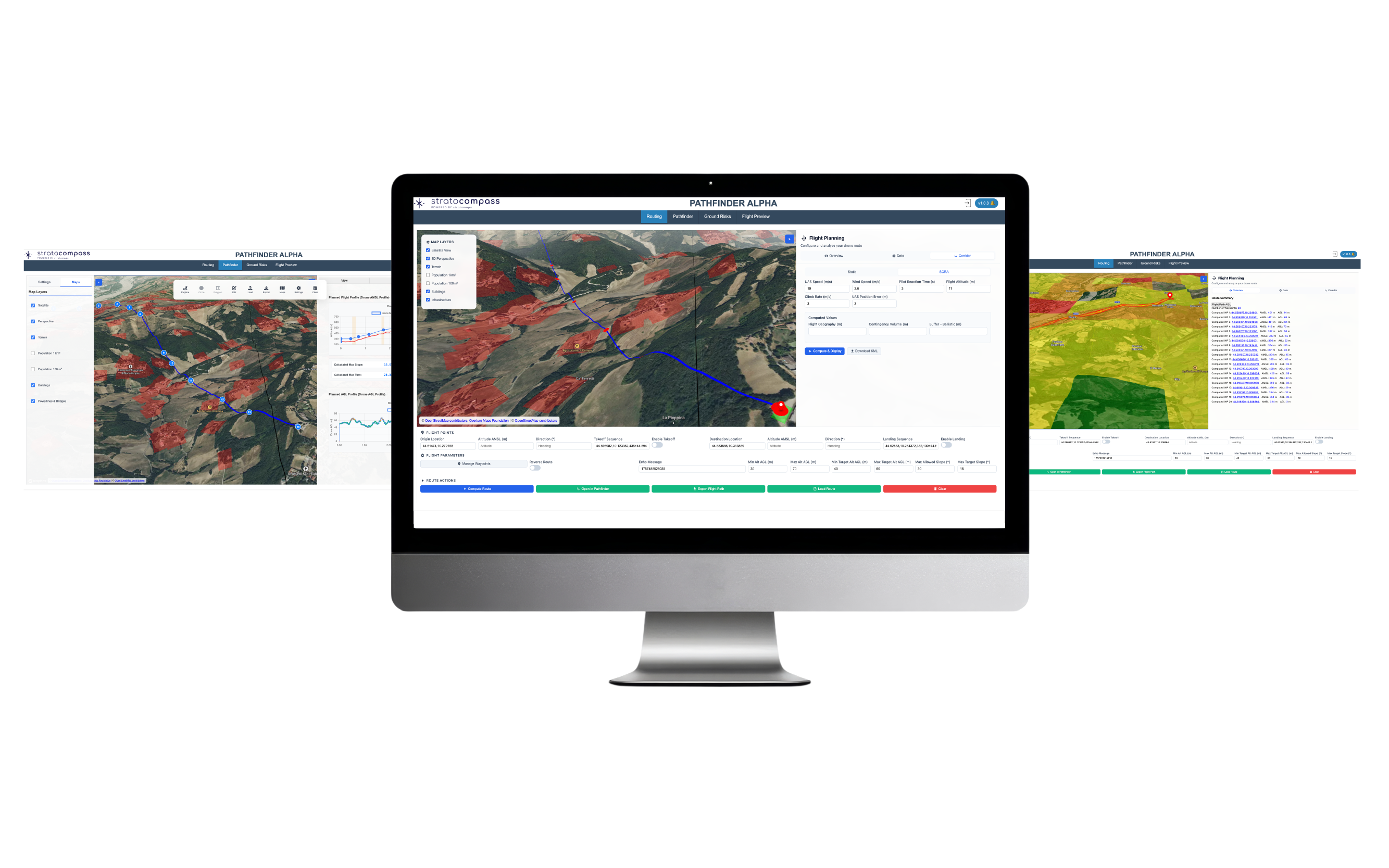
For drone operators, planning optimal routes, whether for BVLOS deliveries, infrastructure inspections, mapping, or land surveying, typically means juggling multiple open-source or commercial tools while hunting for reliable map data. This fragmented, manual workflow is:

Complex
Requires significant expertise and coordination among multiple stakeholders.

Time Consuming
Extensive planning time and the use of multiple tools.

Errors Prone
Increases the risk of mistakes due to the manual nature of the process.
With no Geospatial Intelligence, designing a single 20km compliant route can take up to three days, accounting for all the operationals and regulatory parameters. In the context of a SORA (Specific Operational Risk Assessment), iterative feedback from civil aviation authorities often requires route redesigns, restarting the time-consuming manual route design process. This manual workflow makes it nearly impossible to scale operations efficiently or respond quickly to new opportunities.
First Responders
In emergency response scenarios, whether firefighting, urgent medical delivery (like defibrillators), police operations, or search and rescue, every second counts. There's no time for detailed manual planning; responders need software that instantly computes the optimal and safest route to the destination in their operation zone.
Defence
In military logistics and ISR (Intelligence, Surveillance & Reconnaissance) missions, drone route planning operates under fundamentally different constraints than civil operations. Routes must be computed rapidly in contested environments where threats evolve by the minute: artillery zones shift, jamming areas expand, and radar coverage changes with every tactical update. Traditional planning tools, often built for civil airspace, are wholly inadequate for this reality.